TURN SOUTH. KEEP GOING.
Plan Your Trip to Moustique
GPS will usually get you to the last paved road. After that, follow the signs.
Getting here is part of the experience.
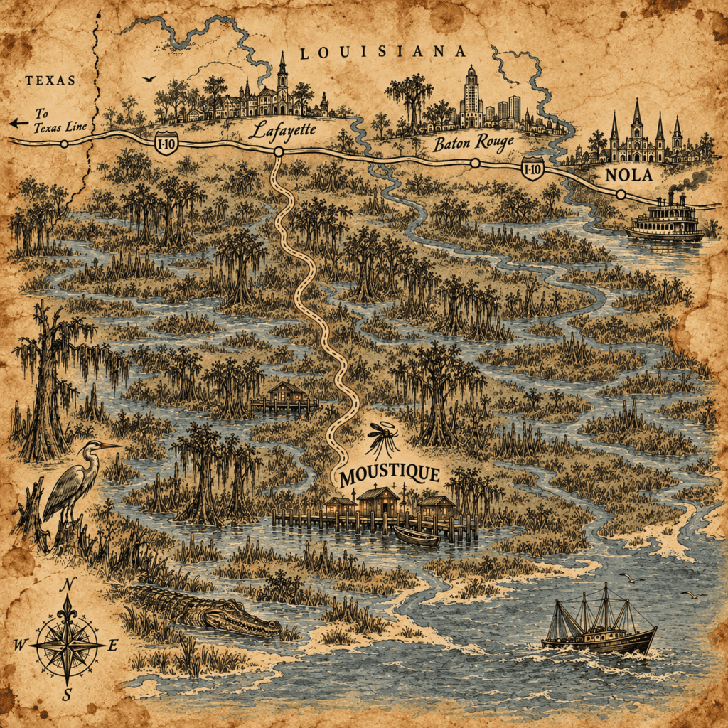
Moustique sits deep in the Broussard Wetlands, far enough from the interstate to feel discovered and close enough to reach in a day. The final stretch is slower: marshland, raised roads, shell, cypress, and fewer bars on your phone.
From either direction, Lafayette is the last easy landmark.
From Baton Rouge
Drive west on I-10 toward Lafayette. Once you reach Lafayette, leave the interstate and head south on rural highways toward the wetlands.
- I-10 West toward Lafayette
- Head south from Lafayette
- Continue as pavement narrows and gives way to shell
- At the weathered cypress sign, take the right fork
- Stay on the raised road until the wetlands open around you
From Texas
Take I-10 east through Lake Charles toward Lafayette. From there, turn south and follow the same rural approach into the Broussard Wetlands.
- I-10 East toward Lake Charles and Lafayette
- Head south from Lafayette
- Continue when the asphalt gives way to shell
- Take the right fork at the old cypress sign
- Follow the road until the marsh closes in on both sides
Final Approach
The last mile is slow. Expect cypress knees, herons, egrets, nutria, occasional alligators, and stretches where the road feels narrower than it looked on the map.
Navigation Notes
- Signal weakens in the wetlands
- Drive slowly after rain and near dusk
- Parking is available near the main dock and Jefferson Ridge
- If you miss a turn, go back to the last sign you recognized
Before You Go
Pack for heat, water, insects, and uneven ground.
Wear
- Lightweight clothing
- Comfortable walking shoes
- Hat or sun protection
- Rain layer in wet weather
Carry
- Bug protection
- Refillable water bottle
- Flashlight or small lantern
- Weather-resistant bag
Nice to Have
- Binoculars
- Low-light camera
- Snacks for longer walks
- A small notebook or offline map
Best Time to Visit
Moustique changes with the season.
Spring
Milder weather, active wildlife, and the Lantern Walk Festival.
Summer
Hot, humid, lush, and best for evening markets and guided water tours.
Fall
Cooler evenings, clearer views, and the Baptiste’s Bend Fishing Derby.
Winter
Quiet season, fewer events, and long boardwalk mornings with less company.
Getting Around
Moustique is compact enough to explore slowly and deliberately.
- Boardwalks are the main way to move between central areas
- Guided airboat routes reach the open marsh
- Small dock shuttles connect selected waterfront points
- Bikes are allowed on designated elevated paths
Accessibility
Most newer boardwalks are elevated, stable, and relatively level. Older paths can be narrower or uneven, especially after heavy rain.
- Check current boardwalk conditions at the General Store
- Bring a flashlight after dark even where lanterns are present
- Ask ahead if you need step-free access to a specific lodging or dock
Safety & Etiquette
Respect the water. Respect the weather. Respect the rules.
- Stay on marked paths
- Avoid low roads after heavy rainfall
- Do not approach or feed wildlife
- Keep noise low at night
- Do not whistle after dark
- Stay on marked paths after dark
Most local rules sound less strange after you have been here a day.
Build the rest of your visit
Stay
Riverside Cabin, Fishing Camp, Cypress Guest House, Off-the-Grid Camp, and Jefferson House.
Eat & Drink
The Lantern House, Broussard Dock Grill, Celeste’s Counter, Cypress Bend Taproom, and the Coldwater Stand.
Events
Lantern Walk Festival, Night Market Nights, Baptiste’s Bend Fishing Derby, the Listening Trees Gathering, and Jefferson Ridge Heritage Day.
Take your time on the way in.
Moustique is easy to reach once you know where you’re going.
The harder part is knowing when you’ve arrived.